
-
Shooting clouds over Mt. Cook (Aoraki)
For the past couple of months, I’ve been working on NSF research with Dr. Brian Billings that I’m very excited to share with you! Thousands of images of incredible New Zealand clouds Brian and I captured are now being used in our cloud stereo photogrammetry research. This work is tied with the DEEPWAVE Mission (several research centers are involved, including NCAR‘s Earth Observing Lab, Naval Research Lab-NRL, and New Zealand’s NIWA).
DEEPWAVE aims to better understand the dynamics of internal atmospheric gravity waves; how moisture (that condenses into clouds) affects the grav-waves and how the waves affect the atmosphere and climate over a longer time frame (they have a big effect on the atmosphere’s momentum budget).
The cloud stereo photogrammetry case I chose to focus on (June 13th shooting clouds over the ocean from Kumara Junction) will allow me to study coastal interactions and a possible barrier jet parallel to the West shore of the South Island. This day provided stunning images that easily became my favorite of them all, as they capture the cumuliform clouds changing above AND the ocean waves moving below! Photos to come…

-
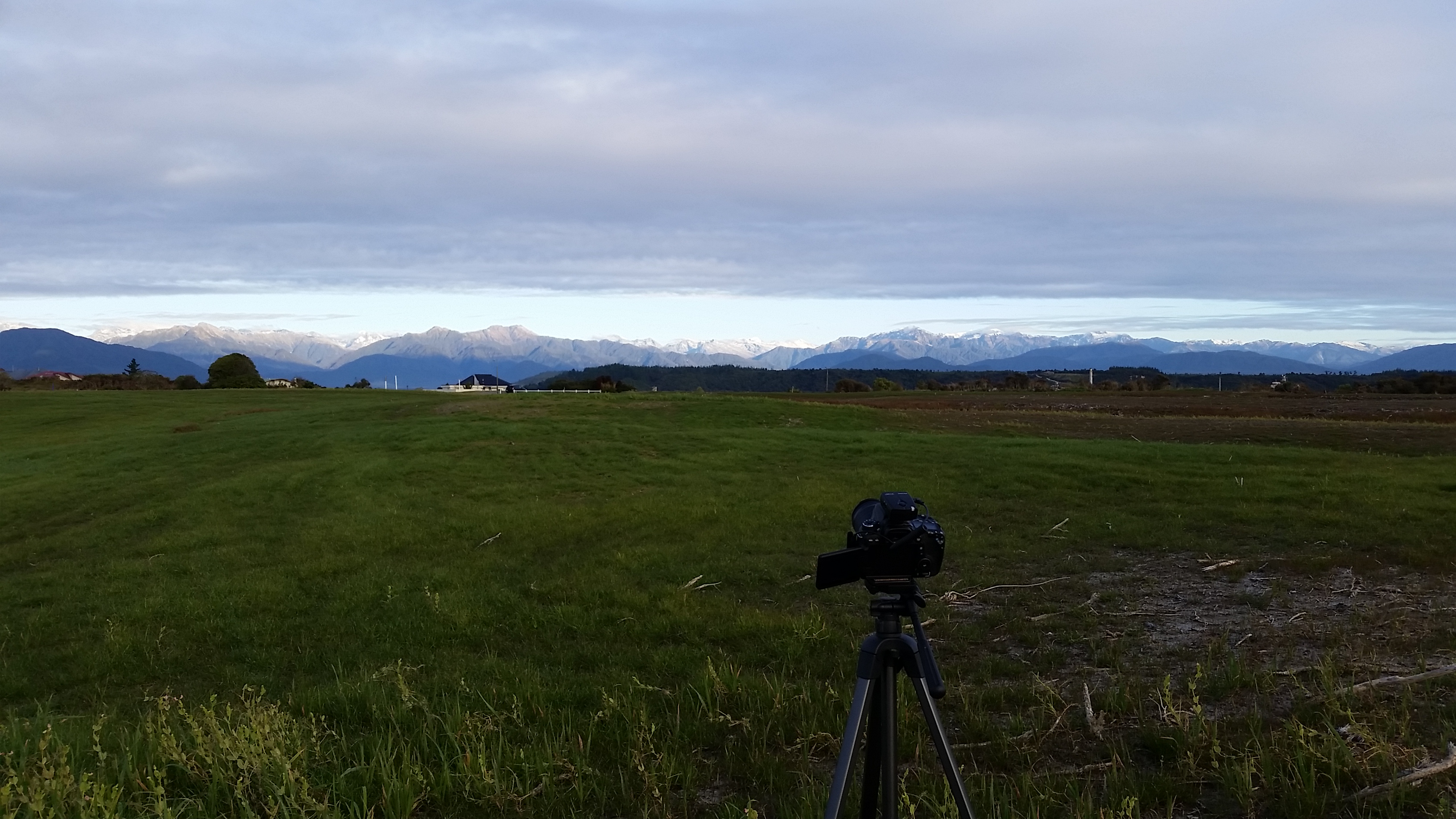
“Stratus”: Arahura Valley, New Zealand
THE PROCESS: I shot with one camera (we cleverly call “Stratus”), while Brian shot with the other (“Cumulus”) at least 250 m away. We first set the cameras on tripods so that we could see one another in the camera view at that distance, then turned each camera 90 degrees in order to capture images parallel to one another. We tilted the cameras to view as much of the sky as possible. Using synchronized timers, we captured images on a set interval of every 5 or 10 seconds.
After each shoot, we saved our images on DVDs and even created time-lapse videos of the beautiful clouds using ImageJ! The main focus with our stereo photogrammetry is to measure the clouds and changes in them, so I’m now using a MATLAB Camera Calibration Toolbox and GPS measurements to perform calculations. Using the triangulation measurements and algorithm results, I can determine how high clouds are and even their distance from mountains or other features to better understand and analyze conditions surrounding each day!
Good criteria for shooting:
- Clouds between clear and overcast (with at least some breaks so it’s “scattered enough”); This way, we still have a clear view of the cloud base and cloud tops
- Would be nice to overlap with field/flight operations (if weather allows)—to capture images that correspond with NSF/NCAR HIAPER GV (research aircraft) flights and dropsondes AND Hokitika weather balloon launches (to represent upstream conditions for the flight)
- Smaller scale atmospheric features resulting from large-scale system—ex. fog forming under a ridge to look at how its form changes over time
- Strong cross-mountain winds–the mountains get in the way of the air flow, creating a disturbance that may cause gravity waves to form
- If there’s Easterly wind flow, we may see leeside weather phenomena (ex. gravity waves—lenticular “UFO” clouds) because of our location on the West side of mountains. This would make us on the leeside of the mountain flow where all the action is!
It was quite an adventure scouting out the best locations for what we’re researching. Many days ran long and late, but I loved it and have learned from it all. All the while, I was fortunate to do field work for NCAR on the DEEPWAVE mission and learn from incredible scientists! I’m now working on stereo photogrammetric analyses for my Senior Thesis. I presented preliminary results at the August AMS Mountain Meteorology Conference in San Diego and will be presenting more about the June 13th case at the American Geophysical Union (AGU) Fall Meeting in San Francisco (December) and the 2015 American Meteorological Society (AMS) Meeting in Phoenix (January)!
Check out our field mission here, and find details on our first flight here! @TashianaOsborne for live updates.
Truly,
Tash

Leave a comment